Best Alternatives to Google Maps [2024]
Last updated on May 21st, 2024 in Privacy
 Google Maps is an excellent navigation tool, but it’s not the only one out there. There are many more options that can help you get around, find places of interest, or even plan an entire journey. If you’re looking for alternatives to Google Maps, then this article is for you.
We’ll be covering 14 popular mapping tools that can help you find your way and make sure you get where you need to go. From open-source solutions to specialized route-finding services, we’ve got something for everyone who needs a little extra help getting from point A to point B. Read on to learn more about some of the best Google Maps alternatives out there!
Table of contents
Google Maps is a web mapping service developed by Google. It offers satellite imagery, aerial photography, street maps, 360° panoramic views of streets (Street View), real-time traffic conditions (Google Traffic), and route planning for traveling by foot, car, bicycle, or public transportation.
Google Maps began as a C++ desktop program at Where 2 Technologies. In October 2004, the company was acquired by Google, which converted it into a web application. After additional acquisitions of a geospatial data visualization company and a real-time traffic analyzer, Google Maps was launched in February 2005. The service’s features have been expanded since its launch; in October 2007, it was added to the suite of data offered on Google’s Keyhole satellite imaging platform and has since been integrated with Google Earth and other mapping services such as Street View.
As of June 2018, Google Maps has over 22 million business listings and 159 million monthly active users.
 OpenStreetMap (OSM) is a free and open-source map platform that is built and maintained by a community of volunteer mappers. It offers a similar level of detail to Google Maps, including street names, building footprints, and points of interest. The app also includes a routing feature that can be used to plan walking, cycling, and driving routes. One of the biggest advantages of OSM is that it’s completely free to use and doesn’t require an internet connection.

Waze is a community-based traffic and navigation app that is owned by Google. The app uses real-time data from other users to provide accurate traffic information, including alerts for accidents, road closures, and speed traps. It also includes a routing feature that can be used to plan routes based on current traffic conditions. Waze is particularly useful for drivers who want to avoid traffic and find the quickest route to their destination.
 HERE WeGo is a map and navigation app that is owned by Nokia. It offers detailed maps for more than 150 countries and includes a routing feature that can be used to plan walking, cycling, and driving routes. The app also includes a public transportation feature that can be used to plan bus and train trips. HERE WeGo is particularly useful for users who want to find the quickest route to their destination and avoid traffic.
 Bing Maps is a map and navigation app that is owned by Microsoft. It offers detailed maps for more than 150 countries and includes a routing feature that can be used to plan walking, cycling, and driving routes. The app also includes a public transportation feature that can be used to plan bus and train trips. Bing Maps is particularly useful for users who want to find the quickest route to their destination and avoid traffic.
MapQuest is a map and navigation app that is owned by AOL. It offers detailed maps for more than 150 countries and includes a routing feature that can be used to plan walking, cycling, and driving routes. The app also includes a public transportation feature that can be used to plan bus and train trips. MapQuest is particularly useful for users who want to find the quickest route to their destination and avoid traffic.
Apple Maps is a map and navigation app that is built into iOS and macOS. It offers detailed maps for more than 150 countries and includes a routing feature that can be used to plan walking, cycling, and driving routes. The app also includes a public transportation feature that can be used to plan bus and train trips. Apple Maps is particularly useful for users who want to find the quickest route to their destination and avoid traffic.

Google Maps Go is a lightweight version of the Google Maps app that is designed for devices with low memory and processing power. It offers the same features as the full version of Google Maps, including detailed maps and routing, but uses less memory and data. This makes it particularly useful for users who have older or less powerful devices.
 HERE Maps is a map and navigation app that is owned by Nokia. It offers detailed maps for more than 150 countries and includes a routing feature that can be used to plan walking, cycling, and driving routes. The app also includes a public transportation feature that can be used to plan bus and train trips. HERE Maps is particularly useful for users who want offline access to maps and routing, as it allows users to download maps for offline use.
TomTom Go is a map and navigation app that is owned by TomTom. It offers detailed maps for more than 150 countries and includes a routing feature that can be used to plan walking, cycling, and driving routes. The app also includes a public transportation feature that can be used to plan bus and train trips. TomTom Go is particularly useful for users who want real-time traffic updates and automatic route adjustments based on traffic conditions.
 Sygic is a map and navigation app that offers detailed maps for more than 200 countries and includes a routing feature that can be used to plan walking, cycling, and driving routes. The app also includes a public transportation feature that can be used to plan bus and train trips. Sygic is particularly useful for users who want to take advantage of advanced navigation features such as lane guidance and speed limit warnings.
 OsmAnd is a map and navigation app that uses OpenStreetMap data. It offers detailed maps for more than 150 countries and includes a routing feature that can be used to plan walking, cycling, and driving routes. The app also includes a public transportation feature that can be used to plan bus and train trips. OsmAnd is particularly useful for users who want to take advantage of advanced features such as offline maps and 3D terrain views.
 Navmii is a map and navigation app that is available for both iOS and Android. It offers detailed maps for more than 150 countries and includes a routing feature that can be used to plan walking, cycling, and driving routes. The app also includes a public transportation feature that can be used to plan bus and train trips. Navmii is particularly useful for users who want to take advantage of advanced features such as offline maps and real-time traffic updates.
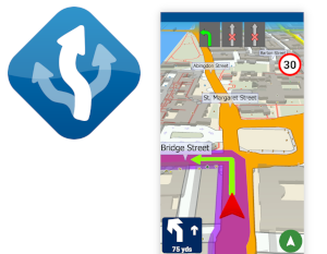
MapFactor is a map and navigation app that is available for both iOS and Android. It offers detailed maps for more than 150 countries and includes a routing feature that can be used to plan walking, cycling, and driving routes. The app also includes a public transportation feature that can be used to plan bus and train trips. MapFactor is particularly useful for users who want to take advantage of advanced features such as offline maps and real-time traffic updates.
 Maps.me is a map and navigation app that is available for both iOS and Android. It offers detailed maps for more than 150 countries and includes a routing feature that can be used to plan walking, cycling, and driving routes. The app also includes a public transportation feature that can be used to plan bus and train trips. Maps.me is particularly useful for users who want to take advantage of advanced features such as offline maps and real-time traffic updates.
Google Maps API is a powerful tool that allows developers to embed Google Maps into their websites and mobile apps. However, it’s not the only option available for developers looking to add mapping functionality to their projects. In this blog post, we’ll take a look beyond maps alternatives and look at some of the best Google Maps API alternatives.
OpenStreetMap API is a free and open-source mapping API that allows developers to access detailed maps of the world. The API provides access to vector data, which can be used to create custom maps, as well as routing and geocoding services. The API is easy to use and allows developers to create a wide range of applications, including map-based games and location-based services.
Bing Maps API is a mapping API that is owned by Microsoft. It provides access to detailed maps of the world and includes a variety of features such as routing and geocoding services. The API is easy to use and allows developers to create a wide range of applications, including map-based games and location-based services. The Bing Maps API also includes a feature for creating 3D maps, which can be useful for certain types of projects.
Mapbox API is a mapping API that is owned by Mapbox. It provides access to detailed maps of the world and includes a variety of features such as routing and geocoding services. The API is easy to use and allows developers to create a wide range of applications, including map-based games and location-based services. The Mapbox API also includes a feature for creating custom maps, which can be useful for certain types of projects.
HERE API is a mapping API that is owned by HERE Technologies. It provides access to detailed maps of the world and includes a variety of features such as routing and geocoding services. The API is easy to use and allows developers to create a wide range of applications, including map-based games and location-based services. The HERE API also includes a feature for creating 3D maps, which can be useful for certain types of projects.
TomTom API is a mapping API that is owned by TomTom. It provides access to detailed maps of the world and includes a variety of features such as routing and geocoding services. The API is easy to use and allows developers to create a wide range of applications, including map-based games and location-based services. The TomTom API also includes a feature for creating custom maps, which can be useful for certain types of projects.
Yandex Maps API is a mapping API that is owned by Yandex. It provides access to detailed maps of the world and includes a variety of features such as routing and geocoding services. The API is easy to use and allows developers to create a wide range of applications, including map-based games and location-based services. The Yandex Maps API also includes a feature for creating 3D maps, which can be useful for certain types of projects.
In conclusion, Google Maps is a great app, but it’s not the only option available, this is why it’s good to have maps alternative. The above-mentioned apps are the best Google Maps alternatives that offer different features and capabilities to suit different types of users or situations. Whether you’re looking for a free and open-source map platform, real-time traffic updates, offline access to maps and routing, or advanced navigation features, there’s an app out there that can meet your needs.